Welcome!
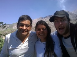
My name is Daniel Williams, and I'm Assistant Teaching Professor in GIS and Remote Sensing at the University of Pittsburgh. I study volcanoes using satellites and thermal cameras, I'm a former NASA NESSF scholar and a National Geographic Explorer. This site is here to give a background of my research and teaching.
I'm part of the Image Visualizations and Infrared Spectroscopy (IVIS) Group at the University of Pittsburgh, where we use various lab, field and satellite instruments to understand volcanoes from their geology to their hazard potential. For more information on the group, please visit ivis.eps.pitt.edu/.
academia.edu - https://pitt.academia.edu/DanielWilliams
ResearchGate - https://www.researchgate.net/profile/Daniel_Williams111
Contact
Email: dbwilliams[at]pitt.edu
Office 509 Space Research Coordination Center
Department of Geology and Environmental Science
University of Pittsburgh
4107 O'Hara Street
Pittsburgh, PA 15260-3332
Office 509 Space Research Coordination Center
Department of Geology and Environmental Science
University of Pittsburgh
4107 O'Hara Street
Pittsburgh, PA 15260-3332
